Fast floodwater a hidden urban danger
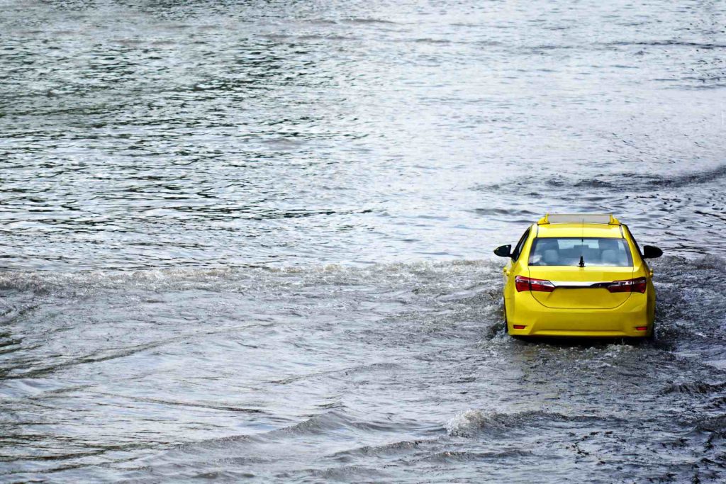
Fast-moving floodwater dramatically increases the risk to urban pedestrians, new modelling has shown.
A Wellington case study showed that walking and driving routes to hospitals, public transport and essential services can be cut off during peak flooding.
Researchers overlaid flood risk maps onto Wellington’s transport network to assess whether people could reach essential services during the peak of a major flood.
While depth-only flood models suggested most residents still could access key destinations, including water velocity showed that several CBD areas were effectively cut off.
Vehicle access was significantly constrained, where steep terrain and narrow streets created choke points that limited movement and evacuation options.
Leading the new research is Dr Lea Dasallas, a Postdoctoral Fellow in UC’s Department of Civil and Environmental Engineering.
Dr Dasallas says that when floodwater flows quickly, even relatively shallow water can be powerful enough to knock people off their feet or sweep vehicles away.
But most public flood maps still focus almost entirely on how deep water gets, not how quickly it flows. The research stresses the need for smarter flood maps and clearer public warnings as extreme rainfall increases.
The modelling was based on an extreme rainfall event simulated under future climate change scenarios rather than current conditions alone.
Dr Dasallas says when flood velocity is included in the assessment, the areas classified as high risk for people walking increased by more than 80%. Medium-risk pedestrian areas, including those for children and older people, more than tripled.
“These are places people still try to drive through or walk across, but once you account for velocity, it becomes clear that those routes are much more dangerous than they appear.”
Identifying safe water in a flood means assessing depth, velocity, and the surrounding terrain together, because fast-moving water, hidden debris, uneven surfaces, and sudden drops can make even ankle-deep flooding unsafe to cross.
“We want to help councils, emergency managers, and the public make more informed decisions before and during flood events.
“That could mean more targeted road closures, clearer public warnings, and better planning for access to hospitals and emergency services that would be based on how water actually behaves, not just how deep it gets.”
The UC researchers warn that as storms intensify, relying on outdated flood assessment methods could increase the risk of injury or loss of life, particularly in cities with steep catchments and dense transport networks.
“Understanding flood velocity is essential to keeping people safe, challenging the common perception that shallow floodwater is safe to cross,” Dr Dasallas says.
Beyond identifying hazards, the researchers developed a framework that integrates flood modelling with transport analysis to guide real-world decision-making during flood events.
The framework enables the identification of streets to avoid and the calculation of safer alternative routes, laying the groundwork for a flood-aware routing system.
As storms intensify, continuing to rely on depth-based flood maps that ignore velocity risks increases injury and loss of life, particularly in cities with steep catchments and dense transport networks.
The research was conducted as part of the Horizon Europe–funded Minority Report project, which focuses on strengthening the resilience of vulnerable urban populations and their built environments to climate-related disruption.